restoration, enhancement, & preservation of over 1,000 acres of endemic wetland and headwater stream habitat of the Cape Fear Region
NORTHEAST CAPE FEAR UMBRELLA MITIGATION BANK
The Holly Shelter Bay site of the Bank is located immediately north of the intersection of NC Highway 210 and Shaw Highway (SR 1522) (approximately 12 miles north of Wilmington, North Carolina) and is situated between Northeast Cape Fear River and the state-protected Holly Shelter Game Lands in Pender County. Its location provides the unique opportunity to be in close proximity to an urban center while at the same time being situated between two natural heritage sites (the Northeast Cape Fear River Floodplain and the Holly Shelter Game Lands) that are considered nationally significant (according to the North Carolina Natural Heritage Program).
The Umbrella Mitigation Banking Instrument (UMBI) includes provision for the incorporation of additional mitigation sites to complement the existing Holly Shelter Bay Tract. The bank is owned and operated by shaw highway properties, llc.
ECOLOGICAL BENEFITS:
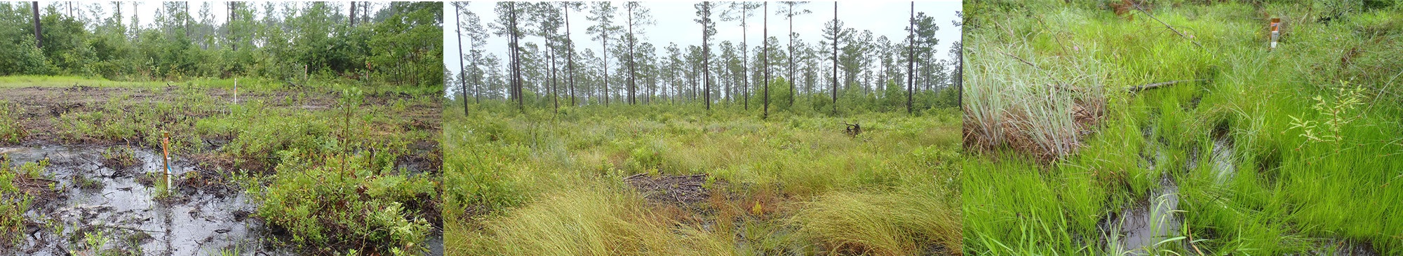
Implementation of the Bank project has resulted in the restoration, enhancement, and preservation of over 1,000 acres of endemic wetland and headwater stream habitat of the Cape Fear Region, North Carolina. Functional benefits resulting from the restoration work include floodwater attenuation and increased nutrient/sediment retention with associated water quality improvements. In addition, the project has resulted in the restoration and protection of refuge and foraging habitat for resident and transient fauna including black bear, American alligator, pygmy rattlesnake, and the endangered red-cockaded woodpecker. Most notably, the Holly Shelter Bay mitigation site provides a protected habitat corridor between two natural heritage sites considered to be nationally significant (the Northeast Cape Fear River Floodplain and the Holly Shelter Game Lands).
CREDIT TYPES AND QUANTITIES:
The Holly Shelter Bay site of the Bank will yield the following credit types and quantities (note that quantities are based upon total credits generated upon completion of Bank milestones).
| MITIGATION TYPE | QUANTITY: |
|---|---|
| Non-Riparian Wetland | 912.1 |
| Riparian Wetland | 2.0 |
| STREAM | 2,300 |
GEOGRAPHIC SERVICE AREA (GSA):
The Bank is located in the Northeast Cape Fear River Basin (Hydrologic Unit Code 03030007) and services over 1,740 square miles of land of the Outer Coastal Plain in southeastern North Carolina. Its service area boundaries include the northern limits of the City of Wilmington, northern New Hanover County, Pender County, Duplin County, and western Onslow County.
*Note that the Northeast Cape Fear Bank may be utilized for impacts beyond the identified GSA on a case by case basis. Please contact Land Management Group with credit inquiries.
Watershed Coverage